Oregonians in Oregon

Over the past few weeks I’ve been traveling Oregon. Getting in deep. Logging 1,400 miles here, 700 miles there, all running around the areas I know, some I don’t, all trying to dig out the feel of what this state really is.
It’s hard to say, now. I mean it’s mostly desert, but what I’m getting at besides a physical description is that, I’m not sure if I’m really an Oregonian.
Working towards my 32nd winter here, and there are still vast stretches of this state filled with towns and people that I’ve never even heard of. I think it’s valid to say I was born in Oregon, but I’m a Portlander. To be an Oregonian, I’m not sure yet, but it feels like I need some more time here.
Some more miles under my tires.
Because, really, this is a huge state, and I’ve been to maybe 18 of its 36 counties.
Can I fly the Oregon flag and say I’m “an Oregonian” – having only seen about 20% of the state?
I dunno.
This go ’round I had two travel companions. One Ryan J Bush, and my trusty tried and true trail pup, Nukka. We bounced out of Portland on a Sunday morning and rolled straight over Mt. Hood and into the Ochoco National Forest. It’s here that I’ll mention we were chased by an aggressive lightning storm through the Warm Springs Indian Reservation. We saw several strikes directly in front of us on neighboring roads. Way to start off cracking.
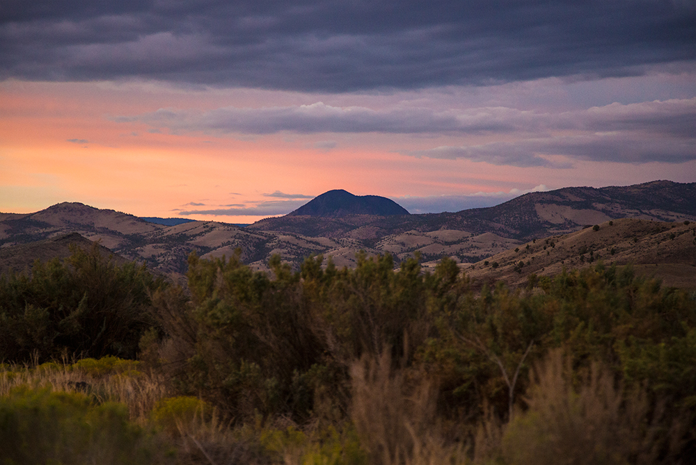
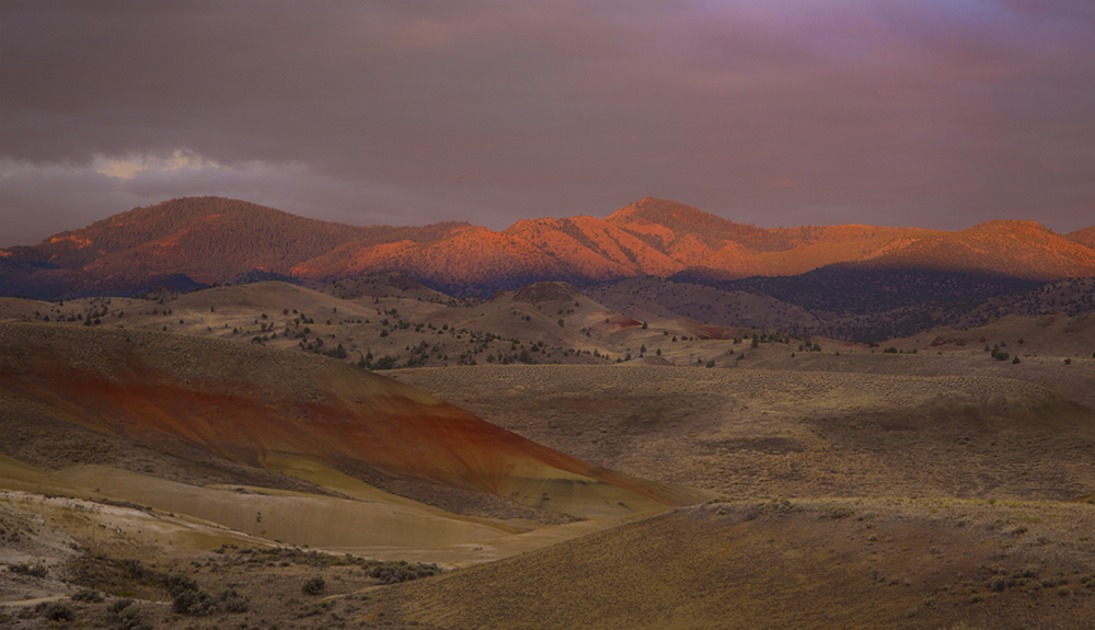
The Ochoco drive-through was my first realization that I know next to nothing about this state. Red ponderosa forests, steep buttes, and craggy, unexpected cliffs in this area are visually arresting.
I wanted to linger, explore, and poke around.
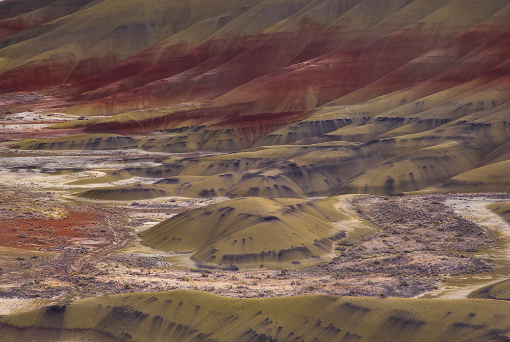
But our objective was the Painted Hills. We found some BLM land to camp on, and stayed to study the morning light on these strange features.
Our reward was color.
We then pushed further SE into the state through John Day, then Burns, on into the nothingness that is the interior of Harney County.
But, in fact, there are wonders in Harney County, just very few people or paved roads. Careful, make good decisions about short cuts. There are no good shortcuts.
We learned.
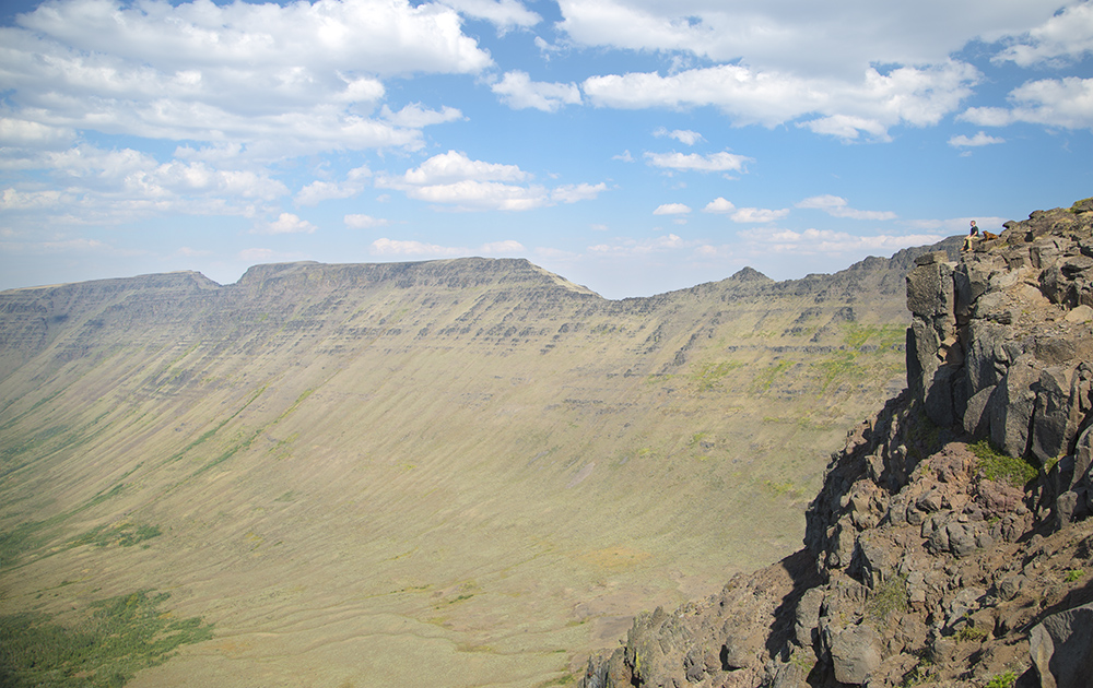
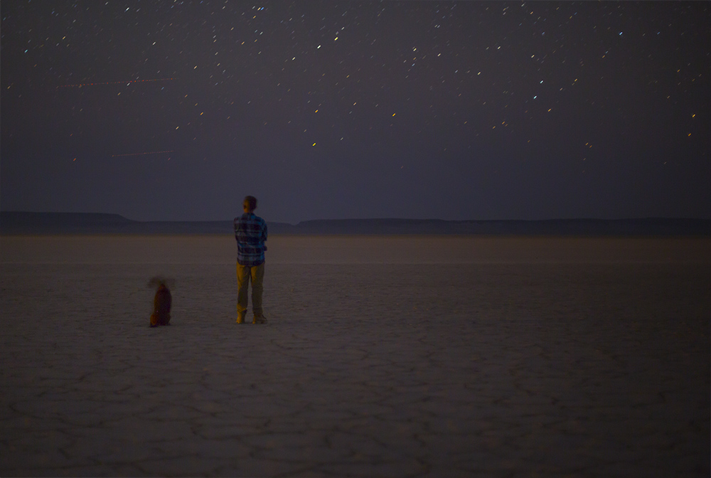
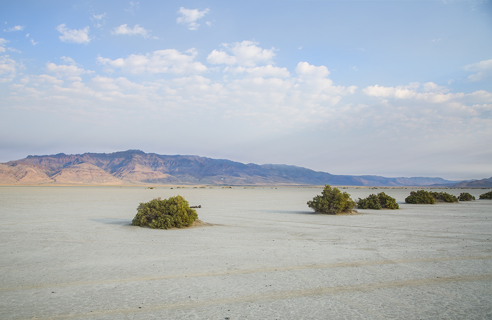
There is this arc of magnificence that stretches from Malheur Wildlife Refuge South to Nevada. It’s everything associated with Steens Mountain, which is the largest fault-block mountain in North America. Everything here is on a megalithic scale. At the base of the mountain is a dry lake bed called The Alvord Desert, the driest place in Oregon. You can drive out on it, camp on it, marvel at it, get lost (it’s easy), or lose your mind during a sunset. We preferred to do all of the above, but also at sunrise. Want to feel like you’re levitating on an alien moon? Come here.
Another region of total spectacular beauty is the Fort Rock and Christmas Valley swath. But that leaves out the path from Steens to Fort Rock, which is nothing less than mesmerizingly bleak. We dipped down into Nevada via Denio, a blip of a border town that straddles the states. In fact you know you’re in Denio after driving over cattle guard, and then suddenly, you’re out of Denio.
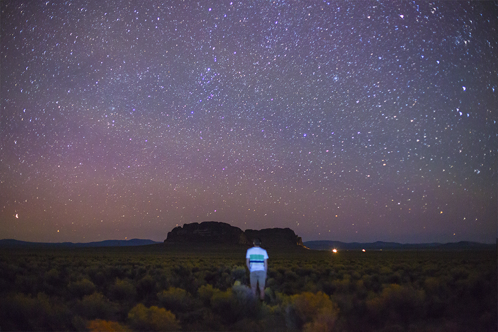
Fort Rock is a powerhouse of energy, stars, sage, and 11,000 years of human history. It was once an island in a vast inland sea. Humans would canoe to it, dig a cave dwelling, and survey their world. Their paleolithic water world.
Nearby is the Derrick Cave system, which I’ve been looking for with great intent. It’s nearly impossible to find. Particularly due to a feud between ranchers and a Government easement that passes through their property. They’ve gated off the south entrance, so you’ve heard it here: approach from the north, and leave from the north. Don’t traverse via the southerly route, you’ll be upsetting ranchers, on their turf, with no cell reception, on a rocky dirt road. Sketch town.
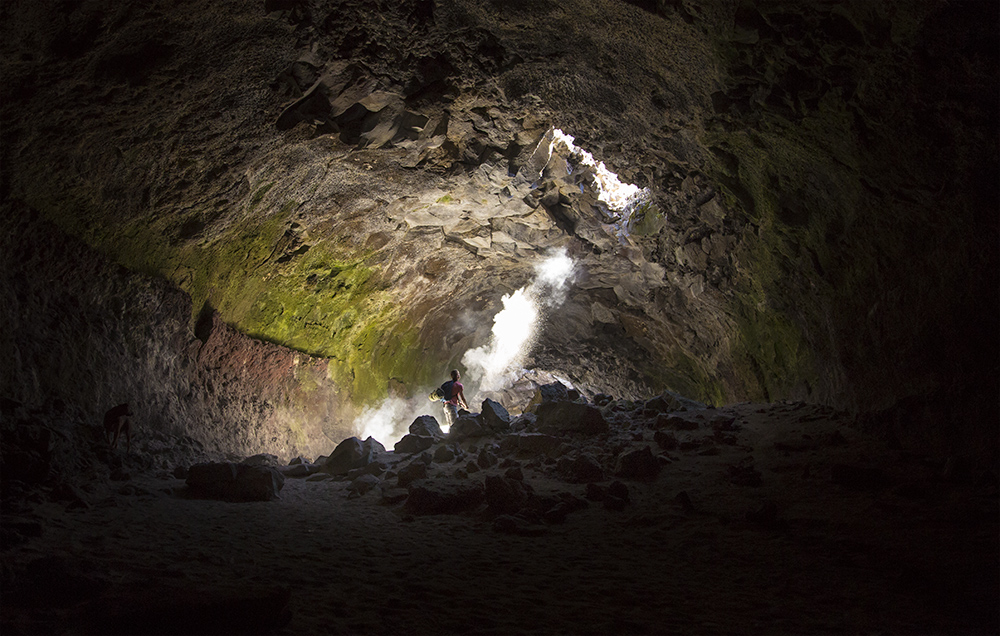
We pushed north after losing all sense of reality in those caves. There is a secondary passage, which contains a small steel window, which leads to another, deeper, darker cave. What is going ON in there!? We poked around, then felt like we were staring into the mouth of Hades, so we casually backed away.
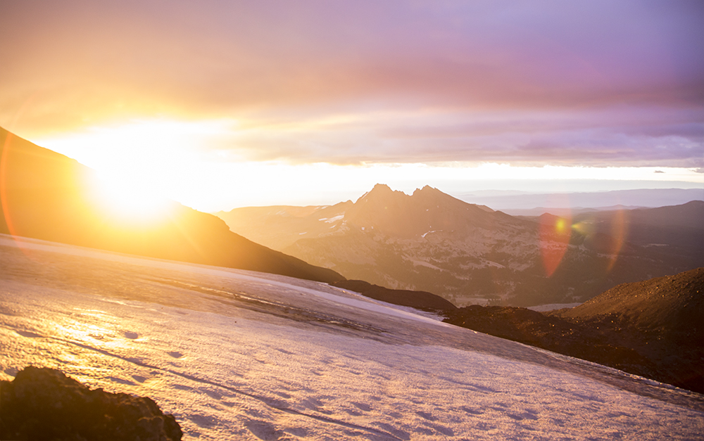
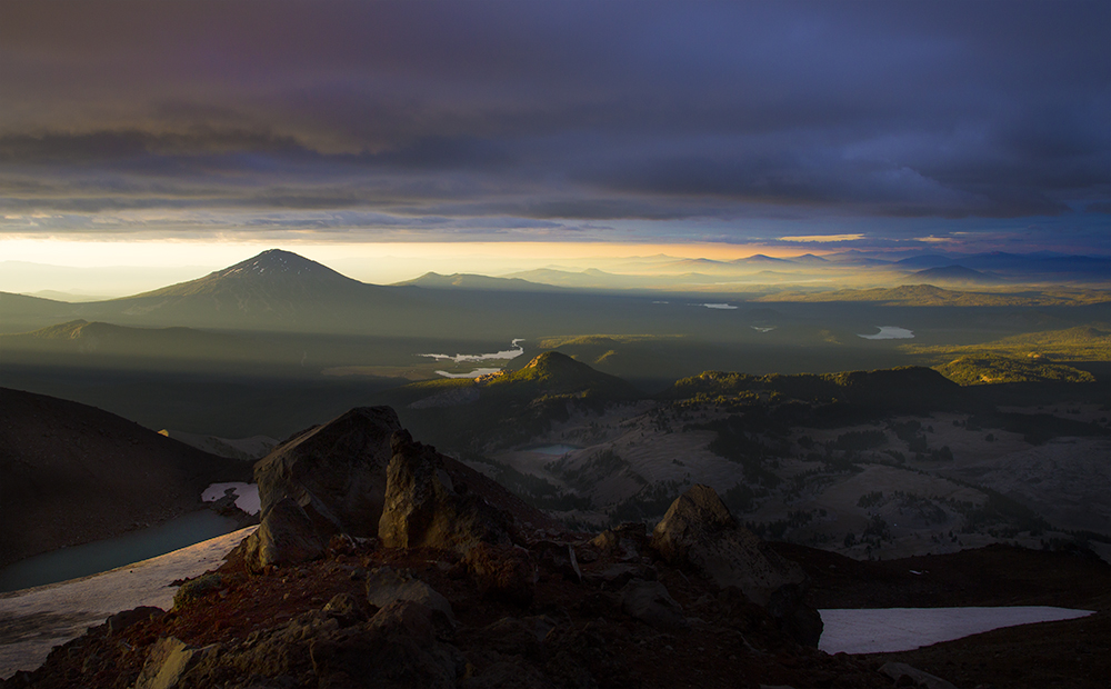
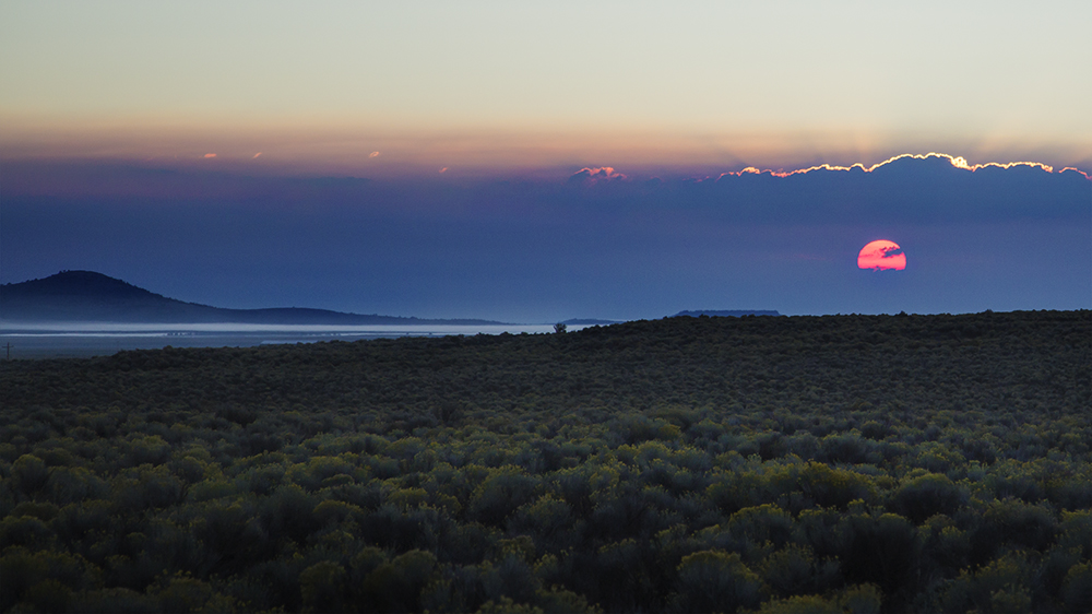
From Fort Rock up to the South Sister, we were traversing the Cascade Lakes wonderland, marked by volcanoes and sky. Seriously, central Oregon is made up of 8 prominent volcanoes all strung in a row from north to south. So, what does a north-south mountain range make during a sunrise? Shadows. Really long shadows. In the last picture above, near the center of the image, is Moraine Lake, where we woke at 3AM to get close to the summit at sunrise. That turned out to be a very long day indeed, and one of the greatest physical challenges of my life. Don’t bring film equipment up a mountain, it very well may kill you.
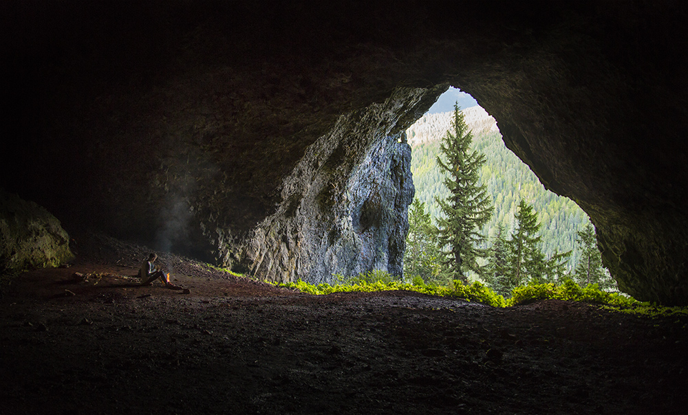
After recovering from the South Sister, we mountain hopped to Mt. Jefferson with the sole intent of descending into another cave. Boca Cave has a 60-foot tall mouth opening and is also difficult to find, being near the summit of Triangulation Peak. On a non-cloudy day the East-facing mouth of the cave looks directly at the West face of Mt. Jefferson. What does that mean? The most epic sunset color display you may ever see, framed by a cave opening. This isn’t Oregon, it’s another planet.
We had clouds that blocked the mountain, but it didn’t matter. We blissed out anyway.
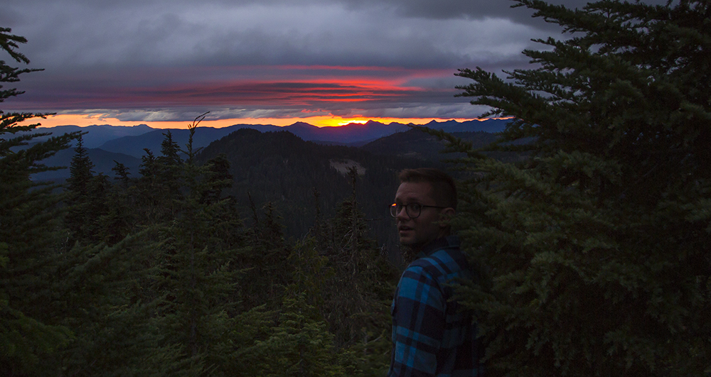
After leaving the cave at dusk, we were surprised by the most beautiful sunset I’ve seen in my life. We ran towards the edge of the hill we were on to peek around the trees and watch the red orb slip behind the Cascade Range, speechless. What a show. What a portal to dimensions of color I never knew.
After getting home, I realized all the mountains, all the valleys, and all the spectacular meadows we drove past and completely missed. The blue alpine lakes, the hanging glaciers, the calderas, all skipped while on our little route.
Is 32 years enough time to really understand Oregon?
Nope.
Aaron, this is beautiful!! I want to go to all these places now. Your writing and the photography is spectacular. Felt like I was there. Love this!
Amazing photos and writing! I’ve only been here 12 years and am still falling in love with the other 80% of the state.
Here are two of my adventures over the last year:
http://bikeportland.org/2013/06/25/exploring-the-oregon-outback-by-bike-89044
http://www.flickr.com/photos/gabrielamadeus/sets/72157633135705658/
Cheers
My daughter Vanessa, an independent film maker, sent this on to me.
I can not tear myself away from the absolute beauty of these Oregon landscapes.and am so grateful for your photos,since it is difficult for me due to my age (87) to make large trips any more. But now I can experience the wonders of our land.
Thank you again, Aaron,
This is SO FUCKING GOOD!
thanks for sharing the stories and photos. I have just begun a 6-month (or longer) bike tour of North America and wont be back to my home in Cascadia for a long time. already missing it.
Hi Aaron,
Beautiful shots of Fort Rock, where I live. Welcome back soon. Love your writing.
Union creek, hershberger lookout, diamond peak, all in south central oregon.
I didn’t tell you that.